
NPS Map OptionsClick on the map to enlarge the image in order to see all of the trail options in the park. In addition to the visual brochure map, the park's official brochure is available in a variety of formats including text-only and audio-only.
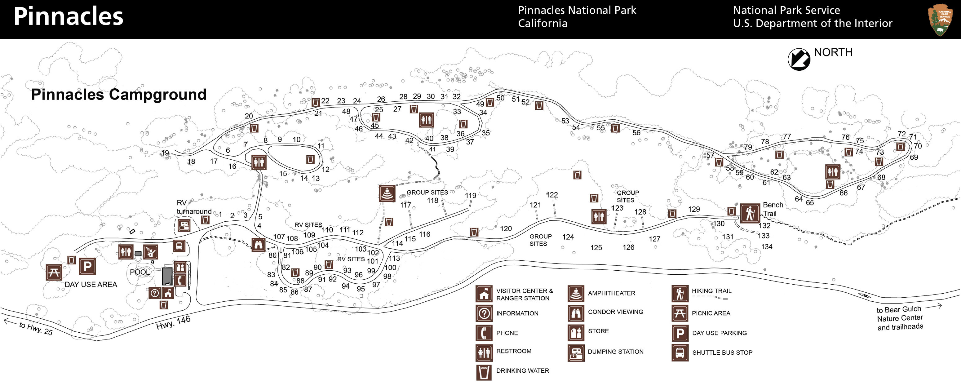
NPS Image Pinnacles Campground is located at the East entrance off of Highway 25 from Hollister, CA (North) and King City, CA (South). Click the link to view a map of the campground. Reserve your site at recreation.gov. 
NPS (Click on the map to enlarge the image) In the High Peaks area, most of the park's trails navigate the Pinnacles formation at the heart of the park. Pay close attention to distances and signage as many trails intersect and connect making rewarding yet complex loops. Triple check your route at every intersection. |
Last updated: March 22, 2023